How to read lake contour maps for bass fishing
If you've ever spent hours idling on a vast Texas lake, casting aimlessly and wondering where in the world the bass are hiding, you know the frustration. It feels like finding a needle in a haystack, especially on unfamiliar water. But what if I told you there's a powerful tool that can essentially give you x-ray vision into the lake's depths, revealing the hidden highways and hangouts bass prefer? This guide is all about mastering lake contour maps, your ultimate secret weapon for locating those elusive lunkers in any Texas reservoir.
Why Lake Contour Maps are Your Bass Fishing Blueprint
Trying to catch bass without a good contour map is like trying to navigate a new city without GPS—you might get lucky, but you're more likely to get lost and waste a lot of precious time. These maps aren't just for navigation; they're detailed blueprints of the underwater world, showing you the subtle (and not-so-subtle) changes in depth, the old riverbeds, the submerged humps, and the steep drop-offs that dictate where bass live, feed, and spawn. For serious Texas anglers, learning how to read a contour map is as fundamental as learning how to tie a knot.
Imagine rolling up to a new lake in East Texas, say Lake Sam Rayburn, a truly expansive body of water. Without a map, you might just cruise around, randomly casting along visible shorelines. With a map, however, you can instantly pinpoint a submerged creek channel intersecting a main lake point, or a deep offshore hump, or a hard bend in an old river channel—all prime targets where bass are known to congregate. This ability to eliminate vast stretches of unproductive water saves you time, fuel, and frustration, directing you straight to where the fish are most likely to be.
These maps are particularly invaluable in Texas's diverse fishing environments. From the deep, clear waters of Canyon Lake in the Hill Country to the vast, timber-filled expanses of Lake Fork, the terrain below the surface varies dramatically. A contour map allows you to adapt your strategy to these unique underwater landscapes, identifying features that might be invisible from the surface but are critical to bass behavior. They reveal the "hidden structure" that experienced anglers constantly talk about.
Understanding the Basics: What Do the Lines Mean?
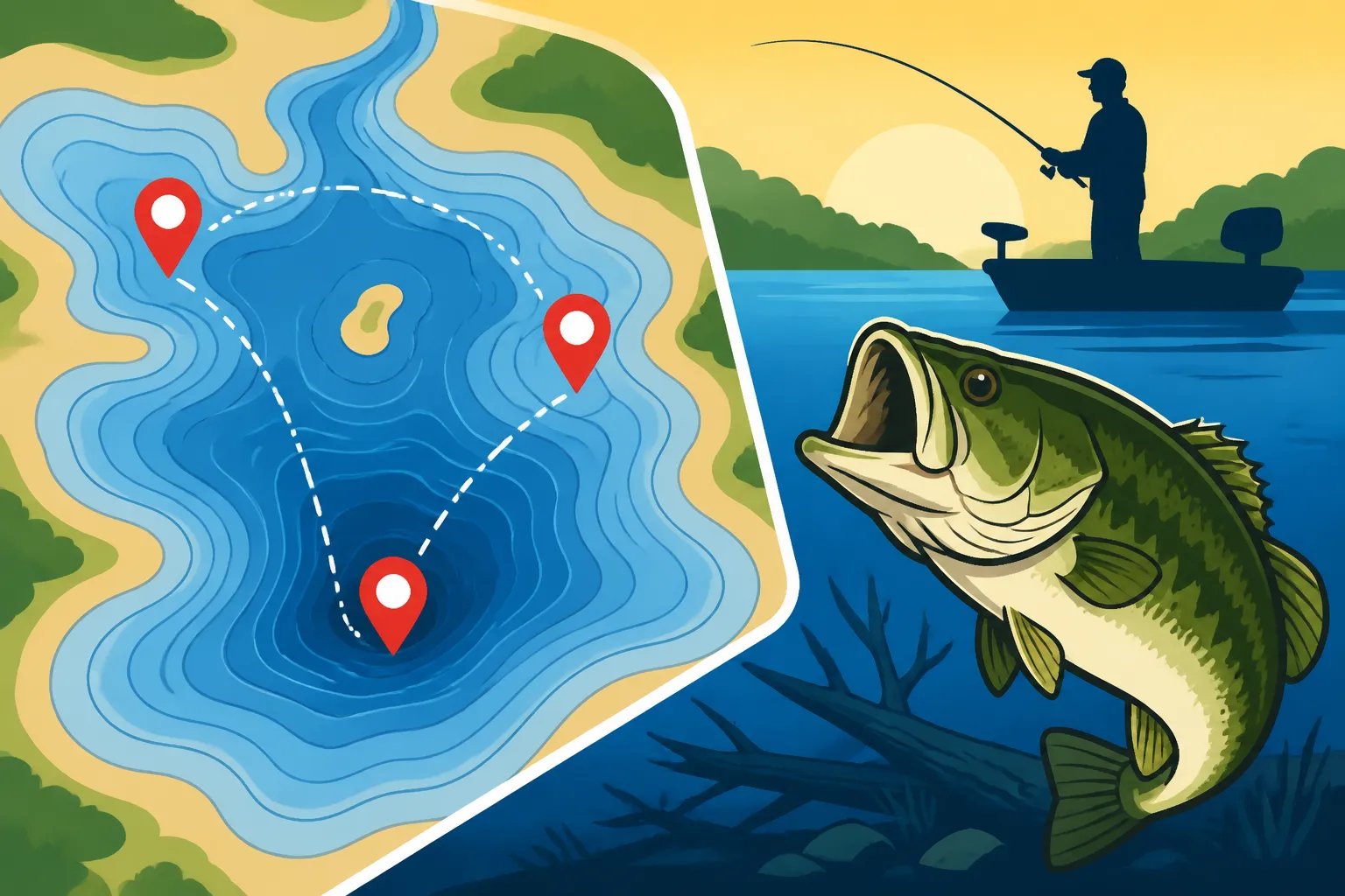
At its core, a contour map is a topographic map of the lake bottom. The most important features you'll see are the contour lines themselves. Think of these lines like the rings on a tree trunk, or elevation lines on a mountain map. Each line connects points of equal depth. So, if a line is marked "10," every point along that line is 10 feet deep. The closer these lines are together, the steeper the bottom drops off. The further apart they are, the more gradual the slope.
This simple concept unlocks a wealth of information. A tight cluster of lines indicates a sharp drop-off, a bluff wall, or a rapidly deepening ledge. Bass often relate to these abrupt changes, using them as ambush points or transition zones between shallow feeding areas and deeper refuge. Conversely, widely spaced lines suggest a gradual, flat bottom, which might hold fish in certain seasons but generally offers less defined structure for them to relate to. Knowing this helps you understand the general lay of the land below your boat.
Beyond the lines, you'll also notice shaded areas or specific symbols indicating different types of bottom composition, vegetation, or man-made structures. Sometimes, darker blue areas denote deeper water, while lighter shades indicate shallower areas. Understanding these basic visual cues is the first step in translating a flat piece of paper or a digital screen into a three-dimensional picture of the underwater world.
Types of Lake Contour Maps Available
The world of lake contour maps has evolved considerably. Gone are the days when a paper map from a bait shop was your only option (though they are still valuable!). Today, you have several formats, each with its own advantages.
One common format is the traditional paper map, often laminated for durability, which you can purchase at tackle shops or online, including on platforms like Amazon. These are great for general overview and planning before you even launch your boat. You can easily spread them out, mark potential spots with a pencil, and get a feel for the entire lake's layout. They’re also reliable; no batteries needed!
Then there are digital maps, which are perhaps the most popular for active fishing. These are integrated into modern fish finders and GPS units. Brands like Lowrance, Humminbird, and Garmin offer incredibly detailed, high-definition mapping with features like "side imaging" and "down imaging" that give you a near-photographic view of the bottom. These digital maps often come with various customizable overlays, allowing you to highlight specific depth ranges or fishing contours. Many top-tier electronics offer pre-loaded maps or allow you to download highly accurate charts, often called "LakeMaster" or "Navionics" maps, which can be indispensable. Learning How to read a fish finder for bass is a natural complement to understanding these digital maps.
Deciphering the Lines: What All Those Squiggly Bits Mean
Once you've got a map in hand—be it paper or digital—it's time to start thinking like a bass. Bass are creatures of structure and transition. They want access to food, cover, and comfortable water temperatures, and they'll use various underwater features to achieve that. Your map shows you where those features are.
Understanding Depth and Contour Spacing
The most immediate information you'll glean from a map is depth. Each contour line represents a specific depth, usually marked with a number (e.g., 5 ft, 10 ft, 15 ft). The intervals between these lines are consistent, often 5 or 10 feet, allowing you to easily estimate the depth of any given area. Pay close attention to these numbers, as bass often prefer specific depth ranges depending on the season and time of day. For instance, in a hot Texas summer, bass might retreat to deeper, cooler water.
As mentioned, the spacing of the contour lines is critical. When the lines are packed tightly together, you're looking at a steep drop-off or a bluff. These can be incredible bass magnets, offering easy access to different depths with minimal effort for the fish. A jig or a deep-diving crankbait fished along such a break can be deadly. Conversely, widely spaced lines indicate a flatter, more gradual slope. While flats can hold fish, especially during feeding times, they often require more searching to find concentrations of bass unless there's some additional cover like stumps or grass.
Consider a scenario on Lake Whitney, known for its limestone bluffs. On your map, you'll see sections where contour lines are almost on top of each other, indicating a sheer underwater cliff. Bass will often suspend along these walls or hold on small ledges and crevices, especially in cooler months. In contrast, if you're exploring the shallower northern end of Richland Chambers Reservoir, you'll see widely spaced contours indicating expansive flats, which can be fantastic for throwing topwater or spinnerbaits over submerged grass beds in the spring.
Interpreting Key Structural Features
Beyond simple depth, contour maps reveal specific structural features that are prime bass real estate. Learning to identify these distinct patterns in the lines is where the magic happens.
One of the most important features is a point. On a map, a point is represented by contour lines that extend outward into the main body of water, forming a "finger" or "nose" shape. These are natural congregation areas for baitfish and predators alike. Bass often sit on the sides or the very tip of points, especially those that drop off steeply. A long, tapering point might have bass scattered along its length, while a short, sharp point could hold a concentrated school.
Humps and islands are another goldmine. A hump is an underwater hill, depicted by a series of concentric contour lines that get progressively shallower towards the center. An island is essentially a hump that breaks the surface. Bass use these isolated structures as ambush points, especially if they're surrounded by deeper water. Finding a hump near a creek channel is like hitting the jackpot. You might even find them on Best Bass Lakes in Texas by studying your maps.
Creek and river channels are highways for bass and baitfish. On a map, these appear as winding, deeper trenches, often with distinct bends. The original river or creek bed before the lake was formed is a constant draw for bass. Pay close attention to where these channels intersect points, humps, or flats, as these intersections create prime feeding zones. A sharp bend in a creek channel can act as a natural current break, attracting schooling fish.
Ledges and roadbeds are depicted as a sudden change in depth along a relatively straight line, or a distinct raised feature (roadbed) that crosses deeper water. Ledges offer vertical relief and are phenomenal for bass, providing easy access to different depths. Old submerged roadbeds, often marked explicitly on newer maps, act as excellent travel corridors and holding areas for bass, especially if they have culverts or bridges that create additional cover.
| Contour Map Feature | Visual on Map | Why Bass Love It | Fishing Strategy |
|---|---|---|---|
| Tight Contours | Lines close together | Steep drop-offs, bluff walls, quick depth changes; ambush points, deep refuge | Jigs, deep crankbaits, Carolina rigs along the break; vertical presentations |
| Wide Contours | Lines far apart | Gradual slopes, flats; feeding areas, potential for submerged grass/cover | Spinnerbaits, swimbaits, topwater (if shallow); slow rolling baits |
| Points | Lines extending into water (finger shape) | Funnel baitfish, transition zones; easy access to deep/shallow water | Crankbaits, jigs, Texas rigs cast across/along the point |
| Humps | Concentric lines getting shallower towards center | Isolated structure, ambush points; often surrounded by deeper water | Drop shots, jigs, deep crankbaits, spoons fished on top and sides |
| Creek Channels | Winding, deeper lines (trench-like) | Migration routes, food highways; natural current breaks, deep refuge | Carolina rigs, deep crankbaits, football jigs along channel edges/bends |
| Ledges | Distinct, often linear depth change | Vertical cover, ambush spots; bass stack up along these breaks | Deep crankbaits, jigs, Texas rigs, drop shots worked along the edge |
| Roadbeds | Raised, linear feature crossing deep water | Travel corridors, cover (especially old bridges/culverts); baitfish routes | Crankbaits, jigs, swimbaits fished on top and along edges |
Spotting Bass Gold: How to Find Key Structures
Reading the lines is one thing, but translating them into actual fishing success means understanding how bass use these structures throughout the year. It's about combining the map with seasonal patterns and fish behavior.
Identifying Productive Intersections and Transitions
Bass are inherently lazy and opportunistic. They'll position themselves where they can easily ambush prey or retreat to safety. This means focusing your map study on "intersections" and "transitions"—places where two or more features meet, or where one type of habitat transitions into another.
For example, a creek channel swinging close to a main lake point is a textbook bass spot. The channel provides a deep escape route and a travel lane, while the point offers a shallow feeding area. Bass can easily move between the two. Another excellent spot is a hump located adjacent to a deep creek channel. The hump provides structure for fish to relate to and bait to school on, while the nearby channel offers quick access to deeper, more stable water, especially during temperature extremes.
Look for areas where hard bottom transitions to soft bottom, or where submerged timber or rock piles (sometimes marked with specific symbols) are present along a contour break. These subtle changes might not be as dramatic as a bluff wall, but they can be incredibly productive. Learning about How to fish deep structure in Texas reservoirs is all about finding these prime locations. Many anglers use digital maps on their fish finders, which can be purchased from retailers like Amazon, to mark these exact spots with waypoints.
Using the Map for Seasonal Strategies
Your map becomes even more powerful when you apply seasonal knowledge to your interpretation. Bass behave differently throughout the year, and their preferred structures change with spawning, feeding, and temperature cycles.
In pre-spawn (typically late winter to early spring in Texas), bass often stage on deeper points, humps, and channel bends adjacent to spawning flats. They're waiting for the water to warm enough to move shallow. On your map, you'd look for these deeper staging areas leading into wide, shallower coves or flats. This is a great time to study your map to find those key transition zones where How to catch pre-spawn bass in early spring becomes a real possibility.
During the spawn itself, bass move to very shallow, protected areas—flats, backs of coves, and areas with submerged vegetation. While contour maps aren't as critical for pinpointing individual beds, they help you identify the types of areas where spawning will occur, like large, shallow coves protected from wind and current.
In summer, as Texas waters heat up, bass often retreat to deeper, cooler water. This is when offshore humps, deep ledges, creek channels, and submerged timber in deep water become prime targets. Your map will guide you to these deeper sanctuaries. You can find more specific advice on How to Fish in Hot Texas Summers that will directly relate to your map study.
Fall sees bass moving back shallower as temperatures cool, often following baitfish into creek arms and onto main lake points. They'll also feed aggressively, so looking for those points and channel swings that funnel baitfish can be very productive. Your map helps you identify these seasonal migration routes.
Putting it All Together: Planning Your Attack on the Water
Having a beautifully detailed map is only half the battle; the other half is translating that information into a successful day on the water. It’s about merging your map study with real-time observation and effective fishing techniques.
Pre-Trip Planning with Your Maps
Before you even leave the house, dedicate time to study your lake contour maps. Identify 3-5 potential areas you want to explore, based on the structural features you've learned to recognize and the current season. Don't just pick one spot; have a backup plan. Look for areas with a combination of features: a point dropping into a creek channel, a hump near a steep ledge, or a long, tapering flat with an old roadbed running across it.
Mark these potential spots on a paper map or, even better, input waypoints into your boat's GPS unit. This saves valuable fishing time once you're on the water. Research local fishing reports for the specific Texas lake you'll be visiting; these often mention depths and types of structure where fish are being caught, which you can then cross-reference with your map. You can also consult resources like the Texas Largemouth Bass Fishing Guide for general patterns.
Consider what lures and baits you'll need for the structures you've identified. If you're targeting deep ledges, you'll want deep-diving crankbaits, football jigs, or a Carolina rig. If you're exploring shallow, brushy points, a Texas rig or spinnerbait might be more appropriate. Knowing what's below the surface helps you make smart tackle choices from your fishing gear, which you might have stocked up on from Amazon.
On-the-Water Execution and Adjustment
Once you're on the water, navigate to your planned spots using your GPS. This is where your digital fish finder with integrated mapping truly shines. It shows your boat's position directly on the contour map, allowing you to precisely position yourself over the structure you want to fish. For instance, if you've found a promising offshore hump, you can use your GPS to drive directly over it, then circle it, keeping your boat exactly where the fish are likely holding.
Use your fish finder's sonar to confirm what the map is showing. The map tells you where the structure is, but the sonar tells you what's on the structure (baitfish, cover, individual fish). You might see a faint contour line on your map indicating a subtle depth change, but your sonar could reveal it's actually a rock pile or a submerged brush pile teeming with bait. This real-time feedback is crucial for making informed decisions. Many anglers choose to equip their boats with the Best Fishing Electronics for Texas Anglers to maximize this synergy.
Don't be afraid to adjust your plan. If your first few spots aren't producing, review your map for other similar areas nearby. Perhaps the bass are holding slightly deeper or shallower than you anticipated, or maybe they've moved to a more protected side of a point due to wind. Your map is a dynamic tool that should be consulted constantly throughout the day to adapt to changing conditions and fish behavior. Remember, the fish don't always read the textbook, but they almost always relate to structure, and your map shows you exactly where that structure is.
Disclaimer
This article is for general informational purposes only and does not constitute professional advice. Laws, prices and regulations vary by location and change over time. Consult a qualified professional for guidance on your specific situation.