Best GPS Units for Texas Boaters
Navigating the sprawling and often unpredictable waters of Texas can be a real challenge, whether you're chasing trophy bass on Lake Fork, exploring the vast expanse of Galveston Bay, or simply cruising a new reservoir. Without the right tools, it's easy to lose your bearings, miss those prime fishing spots you worked so hard to find, or even run into unexpected hazards. This comprehensive guide is all about helping you understand and choose the best GPS units for Texas boaters, ensuring you have the confidence and capability to explore our incredible waterways safely and successfully.
Why a Dedicated GPS Unit is Crucial for Texas Boaters
You might think your phone's GPS is enough, but out on the open water, especially in Texas, a dedicated GPS unit is truly in a league of its own. Our lakes and coastal areas present unique challenges that demand more robust and reliable navigation tools. It’s not just about knowing where you are; it’s about understanding the underwater terrain, avoiding hidden dangers, and getting back to that secret fishing hole every single time.
Navigating Vast and Varied Texas Waters
Texas is home to some truly immense bodies of water, from the sprawling inland reservoirs like Sam Rayburn and Toledo Bend to the intricate bay systems along our Gulf Coast. Picture yourself on a massive lake after a long day of fishing. The sun is setting, the shoreline looks completely different, and suddenly, those familiar landmarks vanish. It's incredibly easy to get turned around, even for experienced boaters. The sheer scale and often irregular shorelines of our larger lakes, coupled with winding river systems, mean that a simple compass and map often fall short.
Beyond the size, consider the variety of Texas waters. Freshwater lakes can be dotted with standing timber, submerged roadbeds, or intricate creek channels. Our coastal bays feature shallow flats, oyster reefs, and constantly shifting sandbars. Trying to navigate these nuances without precise digital mapping is like trying to drive a car blindfolded. A dedicated GPS unit comes pre-loaded with detailed topographical maps and nautical charts, giving you an eagle-eye view of everything beneath the surface and along the shore, making your journey smoother and safer.
Safety and Emergency Preparedness
While the thrill of the open water is undeniable, safety should always be your top priority. Texas weather can change on a dime – a calm morning can quickly turn into a stormy afternoon with heavy winds and reduced visibility. Imagine a sudden fog rolling in on Lake Travis, or an unexpected squall hitting you out in Corpus Christi Bay. In these situations, knowing your exact coordinates and having a reliable way to plot a safe course back to the ramp or harbor is absolutely invaluable. Your GPS can guide you through murky conditions, helping you steer clear of treacherous shallow areas, rock piles, or old stumps that could severely damage your boat.
Furthermore, in the event of an emergency – perhaps an unexpected breakdown, a medical situation, or needing to report a hazard – your GPS unit provides precise latitude and longitude coordinates. This information is critical for emergency services to locate you quickly. Trying to describe your location based on distant landmarks or vague shoreline features can waste precious minutes. A good GPS acts as your ultimate safety net, allowing you to boat with confidence, knowing you have a powerful tool to protect yourself and your passengers. It's peace of mind on the water.
Unlocking Prime Fishing Spots
For many of us, fishing is the ultimate goal, and a GPS unit is arguably the most powerful tool in an angler's arsenal. Think about those legendary spots – a brush pile on Lake Fork holding monster bass, a productive oyster reef in Aransas Bay, or a deep creek channel bend on Lake Livingston where the catfish stack up. Without a GPS, finding these specific locations again, let alone sharing them accurately with a buddy, is nearly impossible. This is where the magic of waypoints and route tracking comes in.
A quality GPS allows you to mark specific waypoints with incredible accuracy, essentially creating a digital breadcrumb trail back to your honey holes. You can also save detailed routes, follow precise depth contours, and even overlay satellite imagery to identify subtle changes in vegetation or bottom structure. This means you can spend less time searching and more time fishing. Whether you're targeting Texas Largemouth Bass Fishing Guide on a deep hump, chasing Texas Speckled Trout Fishing Guide over scattered shell, or setting up a trotline in a specific river bend, a GPS unit helps you return to those productive zones time and time again, making every trip more efficient and more rewarding.
Key Features to Look for in a Texas Boating GPS
When you start shopping for a GPS unit, you'll quickly realize there's a dizzying array of options. To cut through the noise and find what truly works for Texas waters, it's essential to focus on a few core features that deliver the most bang for your buck and peace of mind on the water.
Mapping and Charting Capabilities
This is arguably the most critical feature of any marine GPS unit, especially for Texas boaters. Our diverse fishing grounds demand highly detailed and accurate maps. You need a unit that comes pre-loaded with comprehensive mapping for the specific areas you plan to fish, be it inland lakes or the Gulf Coast. Look for units that offer high-resolution depth contours, which are invaluable for identifying subtle changes in bottom structure where fish often congregate. The ability to see creek channels, submerged roadbeds, humps, and drop-offs with precision can be the difference between a slow day and a banner catch.
Many units offer advanced mapping options like shaded relief, satellite imagery overlays, and even 3D views, giving you an even clearer picture of the underwater world. For coastal anglers, up-to-date nautical charts that show aids to navigation, water depths, channels, and hazard areas are non-negotiable. Some units also allow for custom mapping, where you can record your own sonar data to create personalized, highly detailed maps of your favorite spots. Remember, generic maps just won't cut it when you're trying to navigate unfamiliar waters or pinpoint that tiny underwater structure that holds fish. The detail in your mapping software is truly what separates a good GPS from a great one. Best GPS mapping for Texas lakes can provide more detailed information on specific mapping features.
Screen Size, Resolution, and Usability
Out on a Texas lake or bay, the sun can be brutal, making screen visibility a major concern. You need a display that is bright, clear, and easy to read even in direct sunlight or when viewed from an angle. Look for units with high resolution and anti-glare coatings. Screen size is another personal preference, but generally, bigger is better for navigation, especially if you're frequently referencing charts or running multiple data screens (like GPS alongside a fishfinder view). Imagine trying to interpret a small screen with tiny text while your boat bounces through a chop – it's frustrating and potentially unsafe.
Beyond just the display, consider the overall usability. Will you be operating it with wet hands, or perhaps even gloved hands in cooler weather? Touchscreen interfaces are popular, but some anglers prefer physical buttons for tactile feedback and reliability in rough conditions. A user-friendly interface that allows for quick zooming, waypoint marking, and menu navigation is paramount. You don't want to be fumbling with complex menus when you should be focused on the water. Think about how you typically operate electronics on your boat and choose a system that aligns with your preferred method of interaction.
Durability and Waterproofing
The marine environment is incredibly harsh, especially on electronics. Heat, humidity, saltwater spray, and sudden downpours are par for the course in Texas. Your GPS unit needs to be built to withstand all of it. Look for units with a high IPX rating (Ingress Protection rating), with IPX7 or IPX8 being ideal, meaning they can withstand submersion or continuous spray. This is not just about keeping the rain out; it's about protecting against accidental splashes or even dropping it overboard if it's a handheld unit.
Saltwater, in particular, can be incredibly corrosive to electronics. If you're planning to fish the Texas coast in Galveston Bay Fishing Spots or other coastal areas, ensure the unit is designed with marine-grade components and robust seals to prevent corrosion. The physical construction should also be rugged enough to handle vibrations, bumps, and the occasional impact that can happen when boating in choppy conditions. You want a unit that's going to last for years, not one that gives up the ghost after a few seasons of tough Texas fishing.
Types of GPS Units for Different Texas Fishing Styles
Just like there are different types of boats and fishing rods, there are various GPS units designed to cater to different angling needs and budgets. Understanding the distinctions will help you pick the right tool for your adventures, whether you’re a minimalist bank angler or a serious tournament competitor.
Standalone GPS Units for Basic Navigation
Standalone GPS units are often the most straightforward and budget-friendly option. These are typically handheld devices, smaller than a smartphone, designed primarily for navigation. They're fantastic for kayakers, wade fishermen, or anglers in smaller boats who just need to mark a few waypoints, track their route, and know their exact position. Think of them as your reliable, no-frills digital compass and map rolled into one. Brands like Garmin and Lowrance offer excellent handheld options that are incredibly durable and boast impressive battery life, perfect for a long day on the water without access to a power source.
While they may not have the massive screens or integrated sonar of their larger counterparts, their simplicity and portability are huge advantages. Many Texas anglers even use them as a reliable backup to their primary boat electronics, just in case something goes wrong with the main system. If you're often exploring new stretches of a river, hiking into remote ponds, or launching a small jon boat where space and power are limited, a rugged standalone GPS could be exactly what you need. They excel at helping you get from point A to point B and, more importantly, safely back to the launch ramp. You can often find a good selection of these at retailers like Bass Pro Shops or online at Amazon.
Chartplotters and GPS/Fishfinder Combos for Serious Anglers
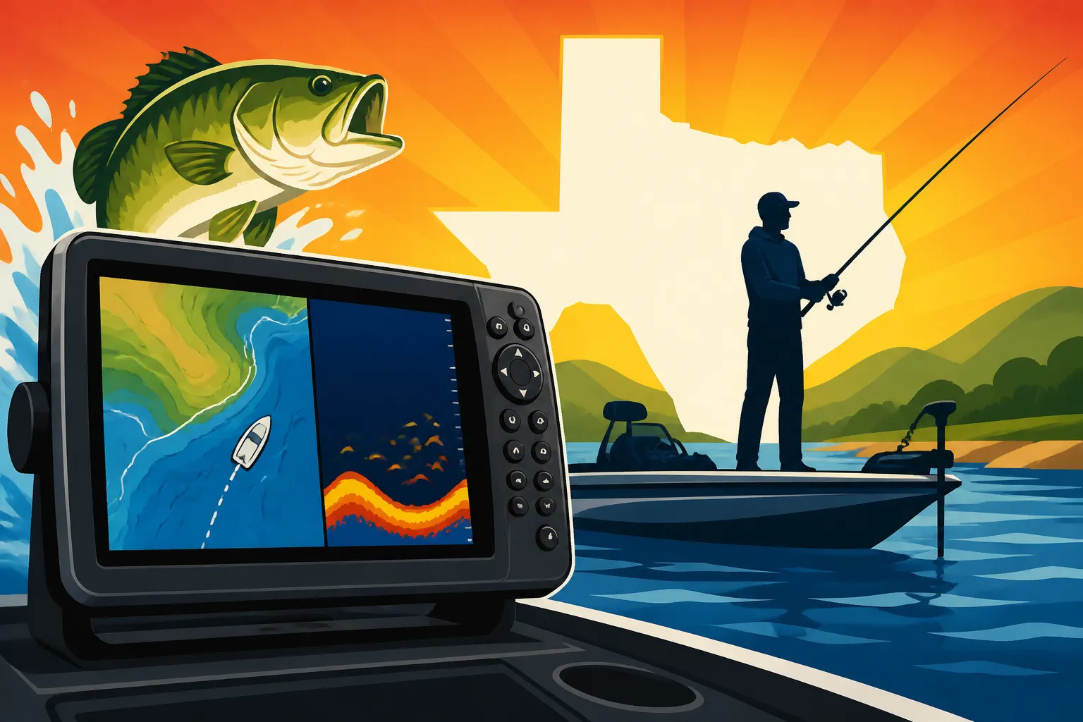
For those serious about their boating and fishing, especially with larger vessels or a passion for advanced techniques, a chartplotter or a GPS/fishfinder combo unit is the way to go. These are the workhorses of marine electronics, integrating multiple functions into one powerful display. A chartplotter, as the name suggests, focuses on displaying detailed electronic charts and navigating routes. When combined with a fishfinder, you get the best of both worlds: precise navigation capabilities alongside advanced sonar technology that reveals underwater structures, depth changes, and, of course, fish. How to use a fish finder for bass fishing is a great resource if you want to understand how these technologies synergize.
These units typically feature larger, high-resolution screens, allowing you to view multiple data feeds simultaneously – perhaps your chart on one side and a detailed sonar scan on the other. They are often networkable, meaning they can communicate with other devices on your boat, like radar, trolling motors, and even engine gauges, creating a fully integrated navigation and fishing system. This level of sophistication is invaluable for covering large areas, understanding complex underwater topography for How to Fish for Bass in Texas, and ensuring you're always on top of the fish. Major brands offer various models, each with specific advantages for different types of fishing, whether you're stalking redfish in the flats or hunting Texas Striped Bass Fishing Guide in deep reservoirs.
Mobile Apps and Tablets as Supplemental Navigation
In today's tech-savvy world, many boaters wonder if their smartphone or tablet, loaded with a marine navigation app, can replace a dedicated GPS unit. The short answer is: they can be an excellent supplement, but rarely a full replacement for serious boating in Texas. Apps like Navionics or C-MAP offer incredibly detailed charts and powerful navigation features, often at a fraction of the cost of a dedicated unit. Their portability and familiar interface are definite pros, and they can be a fantastic way to scout locations from home or serve as a basic backup.
However, there are significant drawbacks. Phones and tablets are generally not built for the harsh marine environment. They aren't truly waterproof, their screens struggle in direct sunlight, and their batteries can drain rapidly, especially when running GPS continuously. A lost signal, a dead battery, or a splash of saltwater can quickly render them useless. While a mobile device might be perfectly fine for a short, casual trip on a familiar pond, for longer excursions, navigating challenging Texas waters, or relying on precise information for safety, a dedicated, purpose-built marine GPS unit will always offer superior reliability, durability, and specialized functionality. Think of your phone as a helpful companion, not your primary guide when serious navigation is at stake.
Integrating Your GPS with Other Boat Electronics
Modern marine electronics are designed to work together, creating a seamless and powerful network that enhances everything from navigation to fishfinding. Understanding how your GPS unit can communicate with other devices on your boat is key to maximizing its potential and transforming your fishing experience on Texas waters.
NMEA 2000 and Ethernet Connectivity
The ability for your GPS unit to "talk" to other electronics on your boat is a game-changer. The two primary ways they do this are through NMEA 2000 and Ethernet networks. NMEA 2000 is an industry standard for connecting various marine sensors and displays, allowing them to share data like GPS position, depth, water temperature, engine information, and more. Imagine having your GPS location displayed on your engine gauges, or your fuel level showing up on your main chartplotter screen. It creates a unified dashboard, reducing clutter and making all your critical information accessible from one or more displays.
Ethernet connectivity, on the other hand, is generally used for sharing larger amounts of data between high-bandwidth devices, such as sonar modules, radar, and multiple chartplotter displays. This allows you to have a single sonar transducer feeding data to all your screens, or to view your radar overlay directly on your GPS chart. If you're running multiple displays or advanced sonar systems, ensuring your GPS unit is Ethernet compatible will unlock a world of integrated possibilities, allowing you to customize your information display to your exact preferences, whether you're navigating the intricate channels of Lake Texoma Fishing Guide or exploring offshore structures in the Gulf.
Trolling Motor Integration and Autopilot
This is where GPS technology truly shines for the serious angler, especially those targeting bass and crappie in Texas lakes. Many advanced GPS units can integrate directly with compatible electric trolling motors, offering features that revolutionize boat control. Imagine using a "Spot-Lock" feature that holds your boat precisely in position over a brush pile, regardless of wind or current, freeing you up to cast without constantly adjusting your boat. This is incredibly useful on windy days on large reservoirs like Sam Rayburn or when you’ve found a productive spot.
Beyond Spot-Lock, some systems allow you to program routes directly into your trolling motor, automatically following a contour line or a track you've previously recorded. This "autopilot" functionality is invaluable for hands-free trolling, allowing you to focus entirely on fishing. You can precisely present your lure along a submerged creek bed or hold your boat on a particular depth line without constantly steering. This integration dramatically increases your efficiency and stealth on the water, making it easier to stay on the fish and maximize your casting opportunities.
Radar and AIS Integration for Enhanced Safety
For those venturing into larger bodies of water or coastal areas, integrating radar and AIS (Automatic Identification System) with your GPS unit significantly boosts safety. Radar allows you to "see" other vessels, landmasses, and weather patterns, even in dense fog, heavy rain, or at night, far beyond what your eyes can perceive. Overlaying radar returns directly onto your GPS chart provides an incredibly powerful navigation tool, helping you avoid collisions and navigate safely through challenging conditions. This is particularly vital when crossing busy shipping lanes or navigating unfamiliar coastlines.
AIS takes this a step further by receiving and transmitting identification information from other AIS-equipped vessels, displaying them as targets on your chartplotter screen. You can see their course, speed, name, and even contact them directly. This is a massive advantage for collision avoidance, especially with commercial traffic or large ships that might not be visible on radar alone. For those Texas Saltwater Fishing Techniques that take you further offshore or into busy bay systems, radar and AIS integration are no longer luxuries but essential safety features, offering unparalleled situational awareness and peace of mind.
Top Considerations Before You Buy
Choosing the right GPS unit for your Texas boating adventures involves more than just picking the first one that looks good. There are practical considerations that can greatly impact your satisfaction and the unit's effectiveness on the water. Taking the time to think through these factors beforehand will save you headaches and ensure you make a smart investment.
Budgeting for Features vs. Needs
One of the biggest hurdles for any boater is figuring out how much to spend. GPS units range from a couple of hundred dollars for basic handheld models to several thousand for advanced, multi-function chartplotter systems. Before you even look at specific models, make an honest assessment of your needs. Are you a casual weekend angler who mainly fishes a small, familiar lake, or are you a dedicated enthusiast who explores vast reservoirs and coastal areas, needing detailed mapping, sonar, and networking capabilities?
Don't overspend on features you won't use, but also don't skimp on essential functions that could compromise your safety or fishing success. Consider the long-term value: a higher-priced unit might come with more robust construction, better screen quality, and more frequent software updates. Factor in potential additional costs like high-definition mapping cards (which can be an extra investment but often worth every penny for detailed Texas water coverage), installation accessories, or even professional installation if you're not comfortable with electrical work. Think of it as an investment in both your enjoyment and your safety on the water. You can find options across all price points at stores like Bass Pro Shops and online platforms like Amazon.
Installation and Mounting
Once you've picked your unit, you need to decide where and how it's going to be mounted. This is not just an aesthetic choice; it's about accessibility, visibility, and safety. For larger chartplotters, you'll typically have options for flush mounting, where the unit is integrated directly into your boat's console for a clean, factory-installed look, or gimbal bracket mounting, which allows the unit to swivel and tilt for optimal viewing angles. Consider the available space on your dash or console. Can you easily see the screen from your driving position? Does it interfere with other controls?
Powering the unit is also a crucial aspect. Most boat electronics run on 12V DC power, but ensuring you have a clean, dedicated power supply with appropriate fusing is vital to prevent electrical issues and ensure reliable operation. If you're not confident with wiring, it's always best to consult a professional marine electronics installer. For handheld units, the considerations are simpler: do you have a secure place to store it, and is it easy to access when you need it? Good mounting prevents vibration damage and ensures your unit stays put, even in choppy conditions on Best Boats for Texas Lake Fishing.
Learning Curve and User Support
Modern GPS units are incredibly powerful, but with power often comes complexity. Some units have intuitive, easy-to-navigate menus, while others can be a bit more daunting for a beginner. Before committing, consider how comfortable you are with new technology. Does the manufacturer offer clear, comprehensive manuals, online tutorials, or even video guides? Good user support can make a huge difference in your ability to fully utilize all the features of your new unit.
Don't be afraid to read reviews from other Texas boaters about their experiences with specific brands and models. Look for comments on ease of use, customer service responsiveness, and the availability of software updates. A unit that's difficult to learn or lacks good support can quickly become a source of frustration rather than an asset. You want to spend your time fishing, not wrestling with a confusing interface. Ideally, your chosen unit should enhance your time on the water, not complicate it.
Texas Boating GPS Unit Comparison
Here's a quick comparison of general GPS unit types to help you visualize their key differences:
| Feature/Type | Standalone GPS Unit | Chartplotter / GPS-Fishfinder Combo | Mobile App (on Phone/Tablet) |
|---|---|---|---|
| Primary Use | Basic navigation, backup, hiking, kayaking | Advanced navigation, fishfinding, integrated boat systems | Supplemental navigation, pre-trip planning, basic backup |
| Screen Size | Small (2-5 inches) | Medium to Large (5-16+ inches) | Varies by device (phone/tablet) |
| Mapping Detail | Good, but typically less advanced contours/features | Excellent, high-resolution charts, 3D, custom mapping | Excellent (app dependent), but relies on device processing |
| Durability | High (rugged, waterproof, long battery life) | High (marine-grade, waterproof, permanent install) | Low (consumer-grade, not typically waterproof/rugged) |
| Power Source | AA/AAA batteries, internal rechargeable | 12V boat power, typically permanent wiring | Internal rechargeable battery (device specific) |
| Integration | Minimal (may connect via USB for data transfer) | High (NMEA 2000, Ethernet, trolling motor, radar, AIS) | Limited (Bluetooth for some accessories, but not boat systems) |
| Ease of Use | Simple, straightforward | Moderate to High (feature-rich, can be complex) | Highly intuitive (familiar device interface) |
| Reliability | Very High (dedicated hardware) | Very High (dedicated marine hardware) | Moderate (reliant on device, battery, signal) |
This table provides a general overview, but specific models within each category will have varying capabilities. Always check the specs for the exact unit you're considering to ensure it meets your individual requirements for your Texas fishing adventures.
Disclaimer
This article is for general informational purposes only and does not constitute professional advice. Laws, prices and regulations vary by location and change over time. Consult a qualified professional for guidance on your specific situation.